Click here for Capital Building: A View from Washington – Part 1
Having finally seen Washington, DC for myself this summer, it was great to connect with this presentation by Marcel Acosta, Executive Director of the National Capital Planning Commission (NCPC), the Federal Planning Agency for America’s Capital. In it he discusses how the city came to be shaped, and how it will continue to be shaped in the future.
Acosta and Beth White, NCPC Commissioner, were guests of the National Capital Commission (NCC) in Ottawa, presenting in September as part of the NCC’s Capital Urbanism Lab public lecture series.
This post is a transcription of that lecture with minor modifications for flow and clarity.
Building a great city – What are the assets and things that being a capital bring to a great city? The capital part plus the local part equals one city. What makes us authentic, unique and so spectacular, vis a vis other cities in our nation, is because we are the capital, it’s part of our tradition, part of our city.
So how do we break barriers down, respectively, between being a capital city and the seat of government and just be a GREAT CITY?
I’ll start with our special relationship with Canada. I’ll note that the physical location of the Embassy of Canada is in a unique location on Pennsylvania Ave, between the Capitol and the White House. It really signifies the tremendous relationship between our two cities. Designed by Arthur Erickson, it is a special building within our own city fabric and symbolic of the NCC and the NCPC. We share a lot of information and exchange ideas, exchanges about how to deal with particular issues that relate to capitals, such as symbolism, embassies and the like. We share that special relationship in terms of being stewards of our national capitals.
First, I’ll talk about the role of the NCPC and our work and some facts about D.C. because it’s good to have that context. The city is compact, small and fairly dense – 68 sq miles 177 sq kms – with 8 political wards. Unlike other American cities, we function as city, county and state. And it wasn’t until the 1970’s that the city and residents were granted home rule: they finally had the ability to elect their own mayor and city council. Until then, the federal government actually governed on behalf the district residents. It’s kind of odd when you think about it! D.C. was the seat of democracy yet residents couldn’t vote for their own leadership. So local governance is a fairly new thing to D.C.
D.C. has also changed quite a bit. Over time – the past 10 to 15 years – the city has begun a transformation from being a strictly government town, becoming more economically diverse, attracting businesses, technology industries, makers and creators. Accoding to city rankings, it’s popular with millennials, a place where they want to go because it’s now an active, exciting place to be. Thirty years ago it was seen as staid and boring and grey. We’ve made that transition to being a more diverse and eclectic place.
Washington’s population reached its peak of 800,000 in the 1940’s during WW2. Its low point – 550,000 – arrived in the 80’s and 90’s , but we’re making a comeback; it’s projected to reach 800,000 again within two decades. The region is about 5 million people. People want to live in the city and not just commute from the suburbs for work; it’s a kind of reverse commute, people working at the Pentagon, in Fairfax (high-tech) and Montgomery Counties (bio-tech), and heading home to the city. They want to be in the middle of it all.
As part of this reinvention of the city, the government has been a major player in the redevelopment of city. As the government changes its footprint, the landscape changes – many sites are being decommissioned. Former military yards are being recommissioned, and obsolete offices and many sites have been released, to be reused in mixed use developments. For example, half of the Navy Yards, which is 40 acres in size, was deemed surplus. Over time, A series of transactions with the city resulted in a put back for private mixed use redevelopment, The Yards, creating a more lively, livable place. And the new baseball stadium is right next door. The FBI building, which is close to the Canadian embassy, needs a more secure campus and is looking to move to the suburbs. When that occurs, the existing building will be put up for private mixed-use redevelopment. This presents an opportunity to re-anchor and re-focus Pennsylvania Ave. Over time it has become in need of reinvigoriation.
We’ve used the federal redevelopment needs as a way to reignite existing neighbourhoods that have become deteriorated or dilapidated over time. These areas needed an anchor to revitalize so we saw the opportunity to use federal development. The NOMA neighbourhood is one such example.
The National Capital Planning Commission is in charge of planning the federal interests in Washington DC and the surrounding counties of Virginia and Maryland.
It is a 12-member commission comprised of both federal and local representatives: three members are appointed by the President including a member from Maryland and Virginia and two congressional reps – which is similar to having a Prime Minister sit on the commission. These are both the House member and Senate member in charge of overseeing D.C. affairs, in charge of budget appropriations and issues that may affect the district. We have landholding agencies sitting on our commission, as we do not own and manage property; we have neither assets, nor portfolios.
Much of our development is constructed through various federal agencies including the Department of Defense (major military installations), who is a major landholder in the D.C. area. Over 90% of local parks are federally managed and owned by the National Parks Service. They manage everything from the National Mall and Rock Creek Park to neighbourhood parks throughout D.C. This is an example of federal government agencies providing local services. The General Services Administration acts as the developer of federal buildings and properties within the federal government and within our region.
We have four local representatives on our commission: the Mayor, two of his/her appointees, plus the Chair of the City Council.
We’re a commission of stakeholders. When Congress created our charter they felt that local participation was important because without that local institutions couldn’t participate in federal planning decisions. Many of things we build have impacts: on surrounding open space, traffic congestion, and on historic areas within the fabric of the city. Because of these impacts there is a need to include local interests in the development of D.C. projects We see this as a forum for discussion and problem-solving, to resolve issues vis a vis federal development and how it relates to the rest of city.
On the planning side, the NCPC and the District Office of Planning is responsible for prioritizing a comprehensive plan for the national capital, D.C. proper and the greater region. The local planning office overseas district element options including public infrastructure, transportation, housing, municipal facilities and schools. We focus on federal workers, visitors, commemorative work, the placement of foreign embassies, anything on the international front. Together these two docs comprise a comprehensive plan. There’s a series of approvals that we go through with the two bodies. But what comes out of the commission is a comprehensive plan, stipulated by Congress to create ONE great city with shared goals and a shared vision on how we want to deal with our city’s development and future.
With regards to project review, federal agencies submit development proposals to the NCPC for review and approval around military installations and federal campuses, as well as changes to the National Mall (memorials, museums, changes to existing parks and urban spaces, federal campuses and military installations throughout the city). Review of special topics, projects and plans can include: special studies on commemoration; infrastructure planning; and sustainability topics and issues,
The commission has an important stewardship role because important symbols, cultural landmarks and the seat of government are housed within our city. We ensure that our federal operations are safe and secure, that the workforce can get to them, that they’re operating efficiently, that we coordinate our activities with local government and how we house our foreign embassies and missions.
We also realize that although people come to explore and to better understand what we’re all about as a nation, we are not constructing an outdoor museum. We’re not static, not locked in ether, but are a series of places each with their own identity, where people live and work, which change over time.. There is always a creative tension between the local and national interests.


Capital Planning (1791)
Washington, D.C. has always been an intentionally planned capital. The location was chosen because it was the midpoint of our country at that time. It was a place that could represent the ideals of the country and the symbology of our city as a nation; the street layout, federal facilities and symbolic elements would be like the 3-D expression of our democracy.
George Washington hired Pierre L’Enfant to create a plan for the new city. The basis of the plan was a typical American street grid with radiating avenues, where the intersections of the two would create very special places and public spaces where important commemorative works or buildings could be placed.
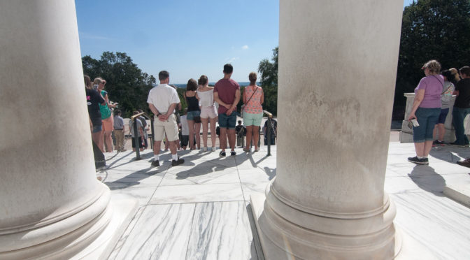
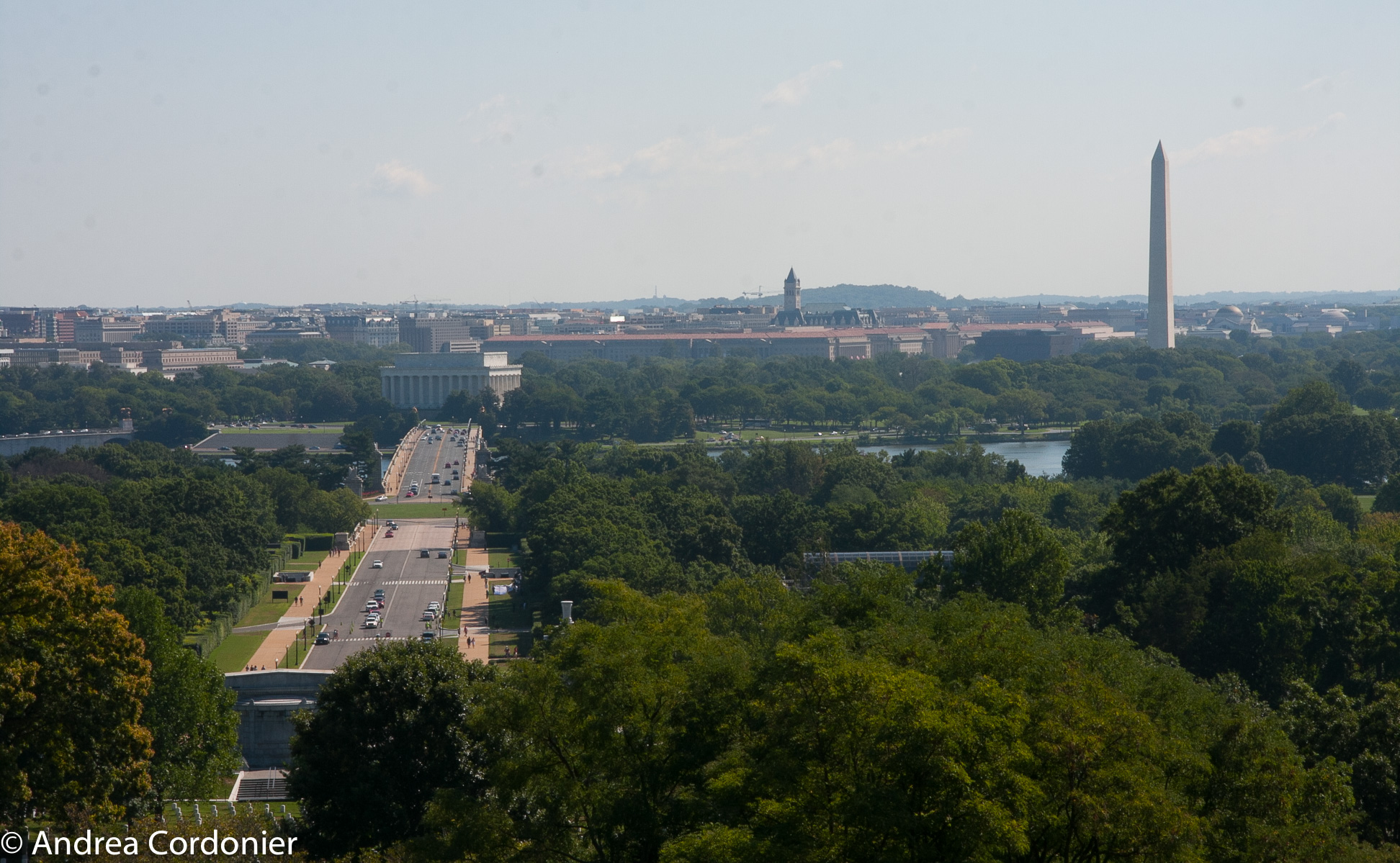
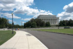
Views and vistas were a very important element in that plan, being able to see and enjoy them, and we’ve inherited that legacy today. The city was placed at the confluence of two rivers, at the bottom of a topographic bowl that presents a remarkable ridgeline as you look out at the city with expressions of nature as part of that. It’s a special spatial relationship that we protect.
The McMillan Plan (1901)
The McMillan Plan presented a different framework for the city, creating a more formalistic aspect to our monumental core and put more focus on the architectural relationship between public buildings and spaces. It resulted in the National Mall you see today. The Mall at that time was much more designed in the english garden fashion. But through the McMillan plan, it became larger and more formal, formally flanked by buildings. The plan also included the national parks and ring of parks within the city, creating the 4 circle parks that included a series of civil war forts that ring the city.


The Legacy Plan (1997)
The purpose of the Legacy Plan was to integrate the fabric of the federal government and formal institutions back into the rest of the city. The focus was to re-center D.C. (the city) on the U.S. Capitol asking: How could we use federal development to spur economic development in other parts of the city? How could we move federal headquarters buildings out to other parts of the city, anchoring development in the other quadrants? How could we integrate the river into the rest of the city life?
Height of Buildings Act (1910)
Washington has a horizontal skyline, a civic skyline not dominated by corporate buildings and their logos. The focus is on the Capitol dome, the Washington Monument and the spires and points expressed throughout the skyline. It is an important part of our identity.
In 1910 the Height of Buildings Act became federal law, enacting height restrictions on the entire city. It was done not for aesthetic purposes but for public safety. Height restrictions would be based on street widths; if a street was 90 feet wide, the buildings along it could be 90 feet high. On commercial streets, which are 100 feet wide, the formula would be 100+20 feet for height, with an overall city cap at 130 feet tall.
As for regional development, the placement of the metro system determines the form of the city, encouraging clustered development/smart growth.
Height Master Plan Review (2012)
In 2012 we undertook a review, conducted jointly with the D.C. Office of Planning to decide whether the Height of Buildings Act should be amended. The Height Act is 100 years. Should we consider changes? Three key guidelines would remain:
- Keep the skyline as expressed.
- Maintain the horizontality of the monumental landscape
- Minimize the impacts to national historic resources
Essentially, we did computer modelling to look at increases in heights and how they would impact the viewscapes of every community. We modelled a variety of iterations for each community.
The outcome was that local representatives wanted to keep the Height Act largely intact! This sent an important message that viewsheds matter. It was a great lesson learned both federally and locally. President Obama signed a minor modification into law that allowed penthouses to be occupied
Comprehensive Plan Revision (2015/2016)
The Comprehensive Plan Revision permitted us to do more detailed research that would focus on urban design. As mentioned previously, we wanted to create a vibrant city using federal development as the driver, and this would be a set of guidelines that would allow us to do that.
We looked at nurturing civic qualities, ensuring that federal development met the highest design-quality standards and that landmarks and important buildings would be set at key locations.
We wanted to expand the idea of vistas and viewsheds and the study focused on this. We worked with Arlington who were considering adding high rises (200-300 feet) which would become the backdrop to the Lincoln Memorial and the Washington Monument. Usual visual tools, they saw how this development would change the viewscape and decided NOT to raise the heights in Arlington. They felt they were shared stewards of the national capital region, and that this was important to their own identity as well as being part and parcel of this important viewscape.
One of our biggest issues facing D.C. is Security and the Public Realm. Safety installations are disruptive on the day to day environment of our streets. Post-9/11 the city became more secure. Jersey barriers and bollards changed the appearance of our streetscapes in the name of security. So we asked: How could we improve the urban design qualities of these features? For example, we had a ring of bollards around the Washington monument. Lori Allwood, a renowned landscape architect tucked security features into the landscape using a low raised wall, which reduces the risk of car bombings. The plan would help balance the needs of the federal government with the need for better pedestrian neighbourhoods. It would return retail at street level, which wasn’t allowed due to security reasons. For example, hardening walls and changing designs ameliorated that problem
Commemoration and the National Narrative
The NCPC reviews all site designs for all memorials in the National Capital Region.
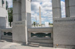
The National Mall is becoming full, leaving very few places to site future museums and memorials. We worked with the public to identify 100 potential sites throughout D.C. knowing that for every 10 year period we could expect to add 1 or 2 museums plus 7 to 10 memorials. These needs arise as sponsors identify new opportunities and figureheads are commemorated.
Another issue is the subject matter of what’s represented in the national narrative, what are the primary themes represented by existing commemorative works on federal land within D.C. Military themed and statesmanship memorials comprise over half of all memorials within the region.
And while there is a heavy emphasis on military monuments, the rest of the country’s story is broader and more diverse than that. We must weave diversity, important events and other subject matter into the fabric of our landscape.
Vietnam War Memorial – For example, interpretation and understanding of the war has changed, and there are sponsors wanting to tell broader stories ie. women in the war. Consideration is being given to an underground visitor centre, adjacent to the memorial, which will discuss the complexities of the war. It raises the question: Where’s the line between a museum and a memorial? in this case, it also raises interesting issues around the future form of commemorative works.
Pershing Park – A new National World War 1 Memorial will be added on Pennsylvania Ave, just a block from the White House, inside Pershing Park So how do you mediate changes to an existing park with the imposition of a new memorial? How do you balance the public uses of the park with the sacred spaces? It raises a series of issues, including the needs of the general population that use that park on a day to day basis.
Future Memorials
There have been two major phases in memorials:
1) The “man on a horse on a plinth”- type, recognizing famous people and events; and
2) The Vietnam Memorial, which is more of a landscape solution.
Landscape memorials takes up a huge amount of land and if you have a lot of these, how does park planning work? Where would you put these 4-5 acre memorials?
As part of the National Park Service’s 100th anniversary, questions were posed: What will monuments look like in the future? How should these memorials be realized? Are there other ways to commemorate events except through marble and stone? What are alternative landscape solutions? What might the topics be for subject matter?
CLICK HERE for Capital Building: A View From Washington – Part 3 that highlights the results of the ‘Memorials for the Future’ international design competition. The competition looked at tech-based, temporary, ephemeral and event-based ideas to create modern memorials for Washington, D.C.